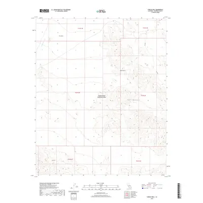
2018 Map of Conejo Well
USGS Topo · Published 2018About this map
Joshua Tree National Park encompasses a significant portion of this arid landscape, preserving the transition between the high Mojave Desert and the Colorado Desert. The topography is dominated by the Eagle Mountains in the southern sections, giving way to the expansive floor of the Pinto Basin to the north. Water movement in this desert environment is traced by ephemeral features like Smoke Tree Wash and Big Wash, which only flow during significant rain events. A critical historical point of interest is Conejo Well, located in the southwest, suggesting a vital water source for travelers or wildlife in an otherwise parched region. The map illustrates a strictly natural landscape, defined more by its geological structures and drainage patterns than by human development.
Find a feature on this map
13 named features on this map. Tap any name to fly to it.
Don’t see what you’re looking for? This feature index may not catch every label — zoom into the map to look around manually.
Map Details
Editions of this 2018 Conejo Well Map
This is the sole edition of this map. No revisions or reprints were ever made.
Other maps of this area

1940 · Cottonwood Spring
USGS Topo · 1:62,500

1940 · Canyon Spring
USGS Topo · 1:62,500

1943 · Canyon Spring
USGS Topo · 1:62,500

1943 · Pinkham Well
USGS Topo · 1:62,500

1944 · Cottonwood Spring
USGS Topo · 1:62,500

1944 · Pinkham Well
USGS Topo · 1:62,500

1944 · Eagle Tank
USGS Topo · 1:62,500

1954 · Salton Sea
USGS Topo · 1:250,000

1955 · Salton Sea
USGS Topo · 1:250,000
1958 · Cottonwood Spring
USGS Topo · 1:62,500