2023 Map of Connellsville
USGS Topo · Published 2023About this map
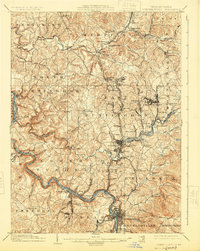
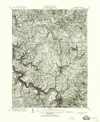
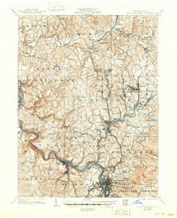
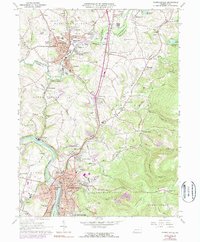
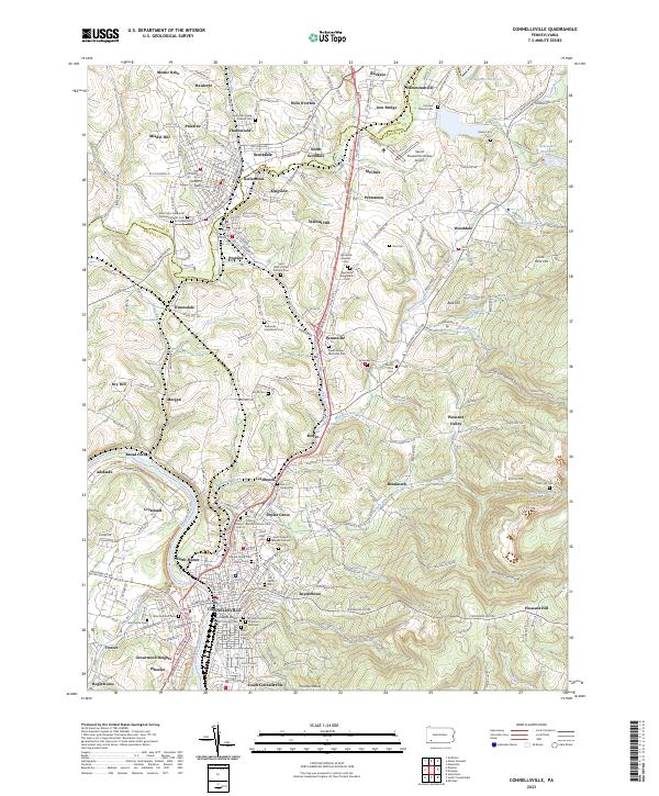
The Youghiogheny River carves through the southwestern corner of this landscape, anchoring the industrial and residential heart of Connellsville. This region is defined by a dense network of burial sites and historical settlements that reflect the deep-rooted community heritage of Fayette and Westmoreland counties. From the urban clusters of Scottdale and Everson in the north to the family-named landmarks such as Miedel Hill and Walnut Hill, the map preserves a detailed record of local genealogy. The Southwest Pennsylvania RR winds through the valley, paralleling water bodies like Mounts Creek and Jacobs Creek. Significant religious and memorial sites, including Saint Joseph's Roman Catholic Cem Old and Green Ridge Memorial Park, are prominent alongside smaller rural markers like Slonecker Cem and Boyd Cem. The terrain rises toward the east into timbered hollows such as Spruce Hollow and Polecat Hollow, illustrating the transition from the river-bottom industry to the high ridges of the Laurel Highlands foothills.
Find a feature on this map
172 named features on this map. Tap any name to fly to it.
Don’t see what you’re looking for? This feature index may not catch every label — zoom into the map to look around manually.
Map Details
Editions of this 2023 Connellsville Map
This is the sole edition of this map. No revisions or reprints were ever made.
Historical Maps of Adelaide Through Time
5 maps found