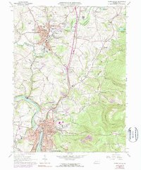
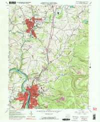
1964 Map of Connellsville
USGS Topo · Published 1977About this map
The Youghiogheny River flows through the heart of the region, defining the industrial and residential development of Connellsville and its surrounding communities. By the mid-1960s, the landscape was a complex network of rail lines including the Baltimore and Ohio, Penn Central, and Norfolk and Western railroads, which serviced the dense corridor between Scottdale and South Connellsville. The survey details an area of transition, where the heavy industry of the riverbank gives way to the rising elevations of Chestnut Ridge to the southeast. Genealogists will find a significant density of religious and burial sites, from the Green Ridge Memorial Park (Cemetery) near Pennsville to smaller parish locations like St Emorys Cem and Paradise Ch. The map also captures several educational landmarks of the era, such as Geibel High Sch and the State Hospital complex, alongside rural features like the Mt Pleasant-Scottdale Airport.
Find a feature on this map
95 named features on this map. Tap any name to fly to it.
Don’t see what you’re looking for? This feature index may not catch every label — zoom into the map to look around manually.
Map Details
Editions of this 1964 Connellsville Map
5 editions found
Other maps of this area

1900 · Uniontown
USGS Topo · 1:62,500

1902 · Connellsville
USGS Topo · 1:62,500

1922 · Confluence
USGS Topo · 1:62,500

1922 · Donegal
USGS Topo · 1:62,500

1931 · Connellsville
USGS Topo · 1:62,500

1931 · Uniontown
USGS Topo · 1:62,500

1931 · Confluence
USGS Topo · 1:62,500

1933 · Confluence
USGS Topo · 1:62,500

1935 · Donegal
USGS Topo · 1:62,500

1936 · Connellsville
USGS Topo · 1:62,500