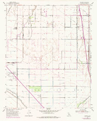
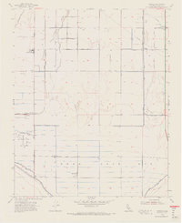
1954 Map of Conner
USGS Topo · Published 1976About this map
Agricultural development and hydraulic engineering define this Kern County landscape as it appeared in the mid-1950s, with later revisions reflecting shifts in the 1960s and 70s. The southern portion of the map is dominated by the Kern Lake Bed, a vast basin where the New Rim Levee Ditch and Old Rim Levee Ditch trace the historical margins of the water. The presence of Kern Lake and the Kern Island Canal illustrates the extensive system of drainage and irrigation required to convert this former wetland into productive land. Industrial activity is concentrated at the Paloma Oil Field, where numerous wells and an Oil Sump are visible.
Find a feature on this map
24 named features on this map. Tap any name to fly to it.
Don’t see what you’re looking for? This feature index may not catch every label — zoom into the map to look around manually.
Map Details
Editions of this 1954 Conner Map
5 editions found
Other maps of this area

1910 · Buena Vista Lake
USGS Topo · 1:125,000

1912 · Buena Vista Lake
USGS Topo · 1:125,000

1914 · Caliente
USGS Topo · 1:125,000

1929 · Stevens
USGS Topo · 1:31,680

1929 · Fairfax School
USGS Topo · 1:31,680

1930 · Weed Patch
USGS Topo · 1:31,680

1930 · Millux
USGS Topo · 1:31,680

1930 · Conner
USGS Topo · 1:31,680

1931 · West of Tejon Hills
USGS Topo · 1:31,680

1931 · Hayes Ranch
USGS Topo · 1:31,680