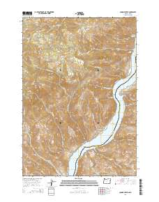
2014 Map of Connor Creek
USGS Topo · Published 2014About this map
Snake River frontage and the steep drainages of the Baker and Washington County line define this portion of the Oregon-Idaho border. The landscape transitions from high points like Sugarloaf Mtn down through dramatic erosional features such as Black Canyon and Golden Goose Canyon. Historically, the area reflects a mix of high-country resources and river-bottom utility, with Sawmill Basin and Quaking Aspen Flat suggesting early timber or grazing activity in the uplands. Near the southern edge of the map, the Hibbard Creek Cem serves as a small but vital landmark for genealogists and local historians, situated near where Hibbard Creek flows toward the Snake River. The map also details the significant footprint of the Brownlee Reservoir, which dominates the canyon floor where the river narrows between the two states.
Find a feature on this map
37 named features on this map. Tap any name to fly to it.
Don’t see what you’re looking for? This feature index may not catch every label — zoom into the map to look around manually.
Map Details
Editions of this 2014 Connor Creek Map
This is the sole edition of this map. No revisions or reprints were ever made.
Other maps of this area

1915 · Pine
USGS Topo · 1:125,000

1951 · Huntington
USGS Topo · 1:62,500

1952 · Olds Ferry NW
USGS Topo · 1:24,000

1952 · Olds Ferry
USGS Topo · 1:62,500

1955 · Baker
USGS Topo · 1:250,000

1957 · Durkee
USGS Topo · 1:62,500

1957 · Mineral
USGS Topo · 1:62,500

1959 · Baker
USGS Topo · 1:250,000

1980 · Brogan
USGS Topo · 1:100,000

1981 · Baker
USGS Topo · 1:100,000