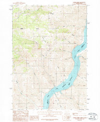
1987 Map of Connor Creek
USGS Topo · Published 1987About this map
The Snake River carves a deep boundary between Oregon and Idaho in this 1980s-era topographical record, where the waters of the Brownlee Reservoir fill the canyon floor. The landscape is defined by dramatic elevation changes, rising from the riverbanks to prominent peaks like Sugarloaf Mountain. This region was historically active for mineral exploration, evidenced by the Snake River Mine and various Prospect markings scattered across the eastern slopes above Big Deacon Creek.
Find a feature on this map
27 named features on this map. Tap any name to fly to it.
Don’t see what you’re looking for? This feature index may not catch every label — zoom into the map to look around manually.
Map Details
Editions of this 1987 Connor Creek Map
This is the sole edition of this map. No revisions or reprints were ever made.
Other maps of this area

1915 · Pine
USGS Topo · 1:125,000

1951 · Huntington
USGS Topo · 1:62,500

1952 · Olds Ferry NW
USGS Topo · 1:24,000

1952 · Olds Ferry
USGS Topo · 1:62,500

1955 · Baker
USGS Topo · 1:250,000

1957 · Durkee
USGS Topo · 1:62,500

1957 · Mineral
USGS Topo · 1:62,500

1959 · Baker
USGS Topo · 1:250,000

1980 · Brogan
USGS Topo · 1:100,000

1981 · Baker
USGS Topo · 1:100,000