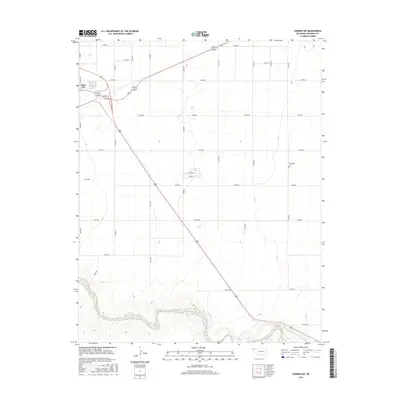
2016 Map of Conrad NW
USGS Topo · Published 2016About this map
Boise City serves as the focal point in the upper western corner of this landscape, where the High Plains terrain is marked by an orderly grid of county roads and highway routes. The map records a transition from the structured residential and commercial blocks of the town out into the sprawling agricultural sections of Cimarron County. The northern reaches are characterized by long, straight thoroughfares such as E0180 Rd and N0300 Rd, which partition the territory into vast sections. To the south, the geometric precision of the road grid yields to the natural meandering course of the Beaver River. This riparian corridor provides a stark contrast to the upland flats, featuring more varied topography as the land descends toward the riverbed. A significant point for local historians and genealogists is Garlington Cem, located along N0350 Rd in the eastern portion of the quadrangle.
Find a feature on this map
28 named features on this map. Tap any name to fly to it.
Don’t see what you’re looking for? This feature index may not catch every label — zoom into the map to look around manually.
Map Details
Editions of this 2016 Conrad NW Map
This is the sole edition of this map. No revisions or reprints were ever made.
Other maps of this area

1954 · Dalhart
USGS Topo · 1:250,000

1958 · Dalhart
USGS Topo · 1:250,000

1962 · Dalhart
USGS Topo · 1:250,000

1969 · Boise City
USGS Topo · 1:24,000

1969 · Flagg Springs
USGS Topo · 1:24,000

1969 · Boise City SE
USGS Topo · 1:24,000

1971 · Keyes SW
USGS Topo · 1:24,000

1971 · Keyes West
USGS Topo · 1:24,000

1971 · Sampsel Lake
USGS Topo · 1:24,000

1971 · Conrad NW
USGS Topo · 1:24,000