
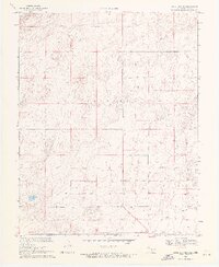
1969 Map of Boise City SE
USGS Topo · Published 1971About this map
The Oklahoma Texas state line serves as the southern anchor for this 1969 topographic survey, marking the jurisdictional divide between Cimarron Co, Oklahoma, and Dallam Co, Texas. The landscape is defined by the broad upland terrain of Cleveland, where the surveyor’s Base Line establishes the geometric order of the High Plains. Unlike the dense settlement patterns of more eastern regions, this corner of the Panhandle is characterized by its wide-open cattle and agricultural spaces. The map reveals the critical infrastructure of a semi-arid landscape, specifically the distribution of dozens of labeled Wells that sustained ranching operations across the section lines. These water sources, often located near lone structures or windmills, illustrate the essential reliance on groundwater in this high-altitude prairie region before modern irrigation reshaped the local economy.
Find a feature on this map
5 named features on this map. Tap any name to fly to it.
Don’t see what you’re looking for? This feature index may not catch every label — zoom into the map to look around manually.
Map Details
Editions of this 1969 Boise City SE Map
2 editions found
Other maps of this area

1954 · Dalhart
USGS Topo · 1:250,000

1958 · Dalhart
USGS Topo · 1:250,000

1962 · Dalhart
USGS Topo · 1:250,000

1969 · Boise City
USGS Topo · 1:24,000

1969 · Boise City NW
USGS Topo · 1:24,000

1969 · Boise City SW
USGS Topo · 1:24,000

1971 · Conrad NW
USGS Topo · 1:24,000

1971 · Conrad SW
USGS Topo · 1:24,000

1973 · Stratford 2 NW
USGS Topo · 1:24,000
1973 · Coldwater West
USGS Topo · 1:24,000