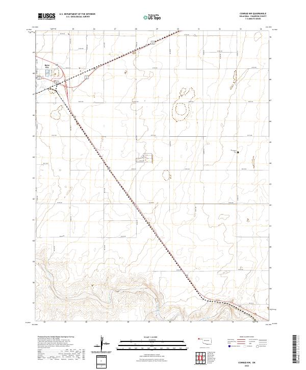
2022 Map of Conrad NW
USGS Topo · Published 2022About this map
Boise City anchors the northwestern corner of this Oklahoma Panhandle landscape, where the town's street grid, including N Hart Ave, meets the diagonal routes of the high plains. The terrain is defined by the vast section-line road network and the winding course of the Beaver River as it cuts through the southern reaches of the quadrangle. These river breaks provide a sharp contrast to the flat, agricultural tablelands to the north. Local history is etched into the land at Garlington Cem, a small cemetery located along N0350 Rd that serves as a quiet marker of the families who settled this part of Cimarron County. The map details the transition from the concentrated development of Boise City to the expansive, sparsely populated sections of the surrounding prairie, reflecting the enduring rural character of this region.
Find a feature on this map
32 named features on this map. Tap any name to fly to it.
Don’t see what you’re looking for? This feature index may not catch every label — zoom into the map to look around manually.
Map Details
Editions of this 2022 Conrad NW Map
This is the sole edition of this map. No revisions or reprints were ever made.
Other maps of this area

1954 · Dalhart
USGS Topo · 1:250,000

1958 · Dalhart
USGS Topo · 1:250,000

1962 · Dalhart
USGS Topo · 1:250,000

1969 · Boise City
USGS Topo · 1:24,000

1969 · Flagg Springs
USGS Topo · 1:24,000

1969 · Boise City SE
USGS Topo · 1:24,000

1971 · Keyes SW
USGS Topo · 1:24,000

1971 · Keyes West
USGS Topo · 1:24,000

1971 · Sampsel Lake
USGS Topo · 1:24,000

1971 · Conrad NW
USGS Topo · 1:24,000