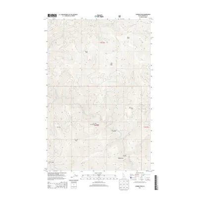
2013 Map of Conrad Peak
USGS Topo · Published 2013About this map
The Saint Joe River snakes through this high-elevation wilderness within the St. Joe National Forest in Shoshone County. This survey reveals a landscape defined by sharp topographical features, from the 6,000-foot heights of Conrad Peak and Whitetail Peak to the prominent Quartz Ridge and Junction Ridge. The distribution of backcountry infrastructure suggests a focus on forest management and recreation rather than permanent settlement. The river corridor serves as the primary artery for movement, hosting the Conrad Crossing Campground and providing access to drainage points like Gold Creek. Named landmarks such as Point Siam, Black Jack Peak, and Beetle Hump provide a detailed look at how this remote Idaho territory was organized and labeled by the Forest Service and Geological Survey in the early 21st century.
Find a feature on this map
17 named features on this map. Tap any name to fly to it.
Don’t see what you’re looking for? This feature index may not catch every label — zoom into the map to look around manually.
Map Details
Editions of this 2013 Conrad Peak Map
This is the sole edition of this map. No revisions or reprints were ever made.
Other maps of this area

1914 · Avery
USGS Topo · 1:125,000

1917 · Avery
USGS Topo · 1:125,000

1918 · St Regis
USGS Topo · 1:125,000

1919 · St. Regis
USGS Topo · 1:125,000

1956 · Saltese
USGS Topo · 1:62,500

1956 · Wallace
USGS Topo · 1:250,000

1957 · Haugan
USGS Topo · 1:62,500

1957 · Simmons Peak
USGS Topo · 1:62,500

1960 · Wallace
USGS Topo · 1:250,000
1969 · Bathtub Mtn
USGS Topo · 1:24,000