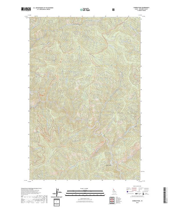
2024 Map of Conrad Peak
USGS Topo · Published 2024About this map
The Saint Joe Wild and Scenic River carves a deep, winding path through this portion of the St Joe National Forest in Shoshone County. High points in the Bitterroot Mountains define the drainage patterns, with Conrad Peak and Whitetail Peak standing as prominent landmarks. The map documents an extensive network of specialized routes, including the Quartz-Haggerty Ohv Trl and Aconite Ohv Trl, which navigate the steep slopes of Junction Ridge and Haggerty Ridge.
Find a feature on this map
72 named features on this map. Tap any name to fly to it.
Don’t see what you’re looking for? This feature index may not catch every label — zoom into the map to look around manually.
Map Details
Editions of this 2024 Conrad Peak Map
This is the sole edition of this map. No revisions or reprints were ever made.
Other maps of this area

1914 · Avery
USGS Topo · 1:125,000

1917 · Avery
USGS Topo · 1:125,000

1918 · St Regis
USGS Topo · 1:125,000

1919 · St. Regis
USGS Topo · 1:125,000

1956 · Saltese
USGS Topo · 1:62,500

1956 · Wallace
USGS Topo · 1:250,000

1957 · Haugan
USGS Topo · 1:62,500

1957 · Simmons Peak
USGS Topo · 1:62,500

1960 · Wallace
USGS Topo · 1:250,000
1969 · Bathtub Mtn
USGS Topo · 1:24,000