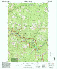
1995 Map of Conrad Peak
USGS Topo · Published 1998About this map
The St Joe River carves a winding path through this portion of the St Joe National Forest in Shoshone County, Idaho. This 1995 survey illustrates the preserved corridor of the St Joe Wild and Scenic River, where the water transitions through a network of major tributaries including Gold Creek, Simmons Creek, and Mosquito Creek. The landscape is dominated by high-altitude ridgelines and peaks that served as critical observation points for forest management, most notably Conrad Lookout Peak and Black Jack Peak.
Find a feature on this map
36 named features on this map. Tap any name to fly to it.
Don’t see what you’re looking for? This feature index may not catch every label — zoom into the map to look around manually.
Map Details
Editions of this 1995 Conrad Peak Map
This is the sole edition of this map. No revisions or reprints were ever made.
Other maps of this area

1914 · Avery
USGS Topo · 1:125,000

1917 · Avery
USGS Topo · 1:125,000

1918 · St Regis
USGS Topo · 1:125,000

1919 · St. Regis
USGS Topo · 1:125,000

1956 · Saltese
USGS Topo · 1:62,500

1956 · Wallace
USGS Topo · 1:250,000

1957 · Haugan
USGS Topo · 1:62,500

1957 · Simmons Peak
USGS Topo · 1:62,500

1960 · Wallace
USGS Topo · 1:250,000
1969 · Bathtub Mtn
USGS Topo · 1:24,000