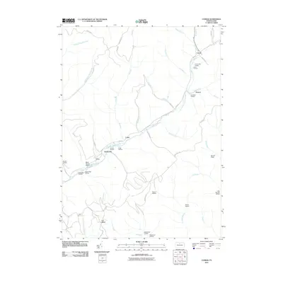
2010 Map of Conrad
USGS Topo · Published 2010About this map
East Fork Sinnemahoning Creek serves as the central artery for this portion of Potter County, where narrow valleys and named hollows dictate the layout of small settlements. The area around Conrad and Jamison is characterized by family-named landmarks and historical sites like the McFall Cemetery and Graveyard Hollow. Further downstream, the junction near Hammersley and Logue reveals a landscape defined by sharp elevation changes, where features like Jordan Hollow and Long Hollow feed into the main waterway. This 2010 USGS survey documents a network of forestry roads, including Forestry Rd and Nelson Run Rd, which provide access to the high ground of Bunnell Ridge. The inclusion of Brooks Cemetery and various remote hollows like Upper Vag Hollow and Shang Hollow makes this a vital reference for local history and genealogy.
Find a feature on this map
50 named features on this map. Tap any name to fly to it.
Don’t see what you’re looking for? This feature index may not catch every label — zoom into the map to look around manually.
Map Details
Editions of this 2010 Conrad Map
This is the sole edition of this map. No revisions or reprints were ever made.
Other maps of this area

1945 · Driftwood
USGS Topo · 1:48,000

1945 · First Fork
USGS Topo · 1:24,000

1946 · Renovo West
USGS Topo · 1:62,500

1946 · Hammersley Fork
USGS Topo · 1:24,000

1946 · Tamarack
USGS Topo · 1:24,000

1947 · First Fork
USGS Topo · 1:24,000

1947 · Conrad
USGS Topo · 1:62,500

1947 · Conrad
USGS Topo · 1:24,000

1947 · Short Run
USGS Topo · 1:24,000

1947 · Ayers Hill
USGS Topo · 1:24,000
Featured Places
- Wharton Township, PA
- Five Points, Wharton Township
- Hammersley, Wharton Township
- Summit Township, PA
- Sylvania Township, PA