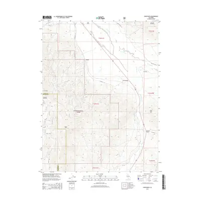
2015 Map of Constantia
USGS Topo · Published 2015About this map
Plumas National Forest dominates the southwestern portion of this landscape, where the terrain rises sharply into the Diamond Mountains. This high-desert transition zone features prominent landmarks like Adams Peak and Crystal Peak, contrasting with the wide expanse of Long Valley to the northeast. The small settlements of Omira and Constantia sit along the valley floor, connected by Constantia Rd and the corridor followed by Highway 395. Water is a defining scarce resource here, represented by the ephemeral Dry Valley Cr and the geothermal Zamboni Hot Springs. The map also captures the path of the Old Indian Trl in the northwest, suggesting long-standing travel routes through this portion of the Great Basin edge. Local history is further grounded by family-named roads such as Homestead Ranch Rd and Hall Rd.
Find a feature on this map
36 named features on this map. Tap any name to fly to it.
Don’t see what you’re looking for? This feature index may not catch every label — zoom into the map to look around manually.
Map Details
Editions of this 2015 Constantia Map
This is the sole edition of this map. No revisions or reprints were ever made.
Other maps of this area

1886 · Honey Lake
USGS Topo · 1:250,000

1886 · Granite Range
USGS Topo · 1:250,000

1890 · Sierraville
USGS Topo · 1:125,000

1891 · Honey Lake
USGS Topo · 1:250,000

1891 · Reno
USGS Topo · 1:125,000

1892 · Sierraville
USGS Topo · 1:125,000

1893 · Honey Lake
USGS Topo · 1:250,000

1893 · Reno
USGS Topo · 1:125,000

1894 · Granite Range
USGS Topo · 1:250,000

1894 · Sierraville
USGS Topo · 1:125,000