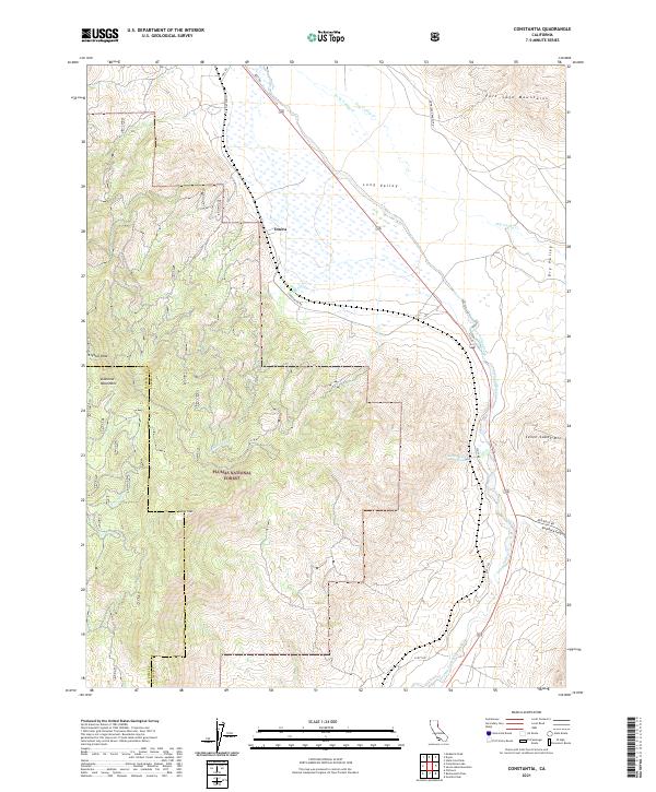
2021 Map of Constantia
USGS Topo · Published 2021About this map
Plumas National Forest blankets the western elevations of this terrain, where the Diamond Mountains and Adams Peak dominate the skyline. The geography transitions sharply from these high peaks down to the drainage basin of Long Valley, where Long Valley Creek and Rhodes Creek flow through the arid lowlands. The settlement of Omira serves as a small anchor point in the northern reach, situated near where the valley floor spreads into seasonal wetlands.
Find a feature on this map
27 named features on this map. Tap any name to fly to it.
Don’t see what you’re looking for? This feature index may not catch every label — zoom into the map to look around manually.
Map Details
Editions of this 2021 Constantia Map
This is the sole edition of this map. No revisions or reprints were ever made.
Other maps of this area

1886 · Honey Lake
USGS Topo · 1:250,000

1886 · Granite Range
USGS Topo · 1:250,000

1890 · Sierraville
USGS Topo · 1:125,000

1891 · Honey Lake
USGS Topo · 1:250,000

1891 · Reno
USGS Topo · 1:125,000

1892 · Sierraville
USGS Topo · 1:125,000

1893 · Honey Lake
USGS Topo · 1:250,000

1893 · Reno
USGS Topo · 1:125,000

1894 · Granite Range
USGS Topo · 1:250,000

1894 · Sierraville
USGS Topo · 1:125,000