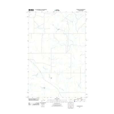
2011 Map of Content NW
USGS Topo · Published 2011About this map
Tillman Number 1 Dam and Tillman Number 2 Dam stand as central features of this Phillips County landscape, illustrating the critical role of water management in this part of Montana. The area is defined by a series of drainage systems, including the southward-flowing Sevenmile Creek and the meandering D H S Creek. These waterways, along with Cottonwood Creek, dictate the layout of the rural road network, most notably Content Rd, which traverses the western half of the quadrangle. The presence of Raymond Dam in the north further emphasizes the human imprint on the natural hydrology of the plains. This 2011 survey captures a sparsely populated region where infrastructure is primarily dedicated to ranching and agricultural water security.
Find a feature on this map
7 named features on this map. Tap any name to fly to it.
Don’t see what you’re looking for? This feature index may not catch every label — zoom into the map to look around manually.
Map Details
Editions of this 2011 Content NW Map
This is the sole edition of this map. No revisions or reprints were ever made.
Other maps of this area

1905 · Bowdoin
USGS Topo · 1:62,500

1954 · Glasgow
USGS Topo · 1:250,000

1957 · Glasgow
USGS Topo · 1:250,000

1958 · Glasgow
USGS Topo · 1:250,000

1968 · Malta East
USGS Topo · 1:24,000

1984 · Clanton Coulee
USGS Topo · 1:24,000

1984 · Pinks
USGS Topo · 1:24,000
1984 · Horse Pasture Coulee
USGS Topo · 1:24,000
1984 · Mitchell Corner
USGS Topo · 1:24,000
1984 · Content NW
USGS Topo · 1:24,000