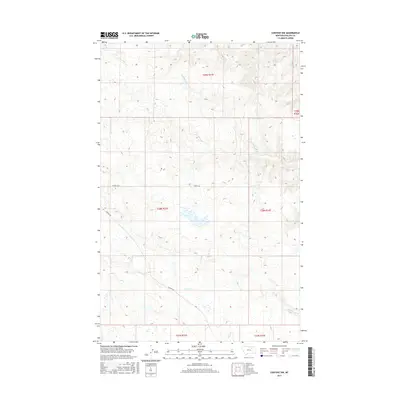
2017 Map of Content NW
USGS Topo · Published 2017About this map
Content Rd traverses this remote portion of Phillips County, serving as the primary corridor through a landscape defined by seasonal drainages and vast grazing allotments. The map details the drainage basins of Sevenmile Cr and D H S Cr, which carve through the undulating terrain of the northern Great Plains. These ephemeral waterways, along with Cottonwood Cr in the southeastern corner, dictate the sparse distribution of ranching infrastructure and land use in this Big Dry country.
Find a feature on this map
12 named features on this map. Tap any name to fly to it.
Don’t see what you’re looking for? This feature index may not catch every label — zoom into the map to look around manually.
Map Details
Editions of this 2017 Content NW Map
This is the sole edition of this map. No revisions or reprints were ever made.
Other maps of this area

1905 · Bowdoin
USGS Topo · 1:62,500

1954 · Glasgow
USGS Topo · 1:250,000

1957 · Glasgow
USGS Topo · 1:250,000

1958 · Glasgow
USGS Topo · 1:250,000

1968 · Malta East
USGS Topo · 1:24,000

1984 · Clanton Coulee
USGS Topo · 1:24,000

1984 · Pinks
USGS Topo · 1:24,000
1984 · Horse Pasture Coulee
USGS Topo · 1:24,000
1984 · Mitchell Corner
USGS Topo · 1:24,000
1984 · Content NW
USGS Topo · 1:24,000