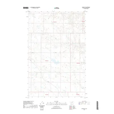
2020 Map of Content NW
USGS Topo · Published 2020About this map
Sevenmile Cr and D H S Cr drain the high plains of Phillips County, carving drainage patterns through a landscape defined by the Public Land Survey System. This 2020 map documents the rural infrastructure of north-central Montana, where the path of Content Rd connects remote ranching tracts. The cartography highlights the systematic division of the land into townships such as t29n r31e and t28n r32e, showing how regional access is maintained through local routes like Swedes Sq and Swedes Sq W. The terrain is marked by intermittent water sources and the headwaters of Cottonwood Cr, illustrating the hydrological challenges and land-use patterns of the Big Sky country in the modern era.
Find a feature on this map
12 named features on this map. Tap any name to fly to it.
Don’t see what you’re looking for? This feature index may not catch every label — zoom into the map to look around manually.
Map Details
Editions of this 2020 Content NW Map
This is the sole edition of this map. No revisions or reprints were ever made.
Other maps of this area

1905 · Bowdoin
USGS Topo · 1:62,500

1954 · Glasgow
USGS Topo · 1:250,000

1957 · Glasgow
USGS Topo · 1:250,000

1958 · Glasgow
USGS Topo · 1:250,000

1968 · Malta East
USGS Topo · 1:24,000

1984 · Clanton Coulee
USGS Topo · 1:24,000

1984 · Pinks
USGS Topo · 1:24,000
1984 · Horse Pasture Coulee
USGS Topo · 1:24,000
1984 · Mitchell Corner
USGS Topo · 1:24,000
1984 · Content NW
USGS Topo · 1:24,000