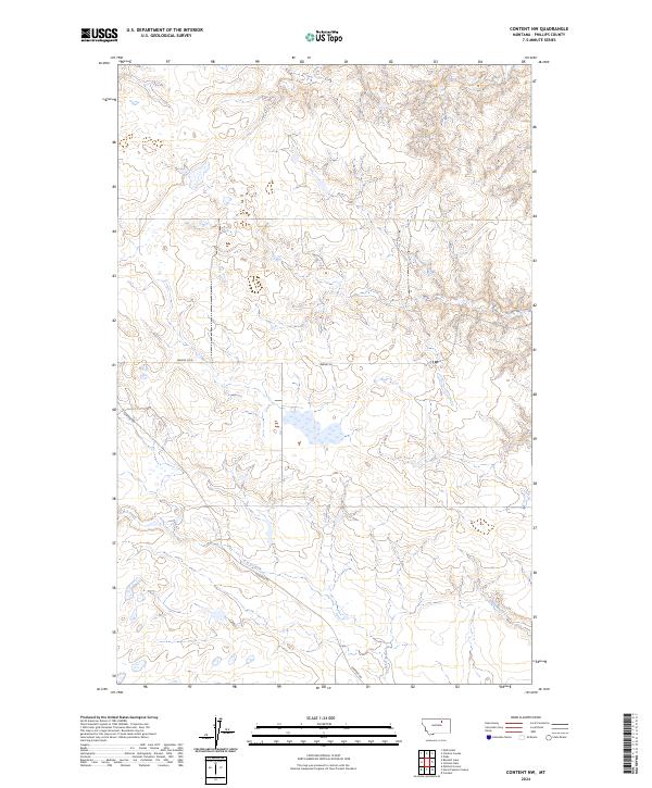
2024 Map of Content NW
USGS Topo · Published 2024About this map
Content Rd winds through this arid expanse of northern Phillips County, tracing a path across the varied hydrology of the Montana plains. The landscape is defined by intermittent drainages, including the branching reaches of D-H-S Creek and the southern flow of Sevenmile Creek. This contemporary survey reveals a section of the American West where the grid of public land surveying meets local nomenclature, such as the areas designated Swedes Sq and Swedes Sq W. The presence of these named squares alongside winding waterways like Cottonwood Creek suggests a history of local land division and ranching routes that persist into the modern day. For those studying the rural geography of the High Line region, the map provides a clear look at how drainage patterns and established roads dictate the layout of this sparsely populated terrain.
Find a feature on this map
13 named features on this map. Tap any name to fly to it.
Don’t see what you’re looking for? This feature index may not catch every label — zoom into the map to look around manually.
Map Details
Editions of this 2024 Content NW Map
This is the sole edition of this map. No revisions or reprints were ever made.
Other maps of this area

1905 · Bowdoin
USGS Topo · 1:62,500

1954 · Glasgow
USGS Topo · 1:250,000

1957 · Glasgow
USGS Topo · 1:250,000

1958 · Glasgow
USGS Topo · 1:250,000

1968 · Malta East
USGS Topo · 1:24,000

1984 · Clanton Coulee
USGS Topo · 1:24,000

1984 · Pinks
USGS Topo · 1:24,000
1984 · Horse Pasture Coulee
USGS Topo · 1:24,000
1984 · Mitchell Corner
USGS Topo · 1:24,000
1984 · Content NW
USGS Topo · 1:24,000