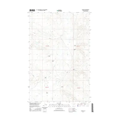
2017 Map of Content
USGS Topo · Published 2017About this map
Content sits at the heart of this Phillips County landscape, where the prairie topography is defined by an intricate network of drainage coulees and seasonal creeks. The terrain transitions from the relatively level Sun Prairie Flats in the southwest to a more dissected series of breaks cut by Beaver Cr and Flat Cr. This 2017 survey reveals the persistent imprint of homesteading and cattle ranching on the Montana plains, primarily through the naming of localized features like Albert Coulee and Trueblood Coulee, which likely reflect the early families who settled this territory. Content Rd serves as the primary artery through the region, connecting isolated points across a landscape where water is the primary architect of the land. Other prominent drainage features including Twin Lake Coulee and No Name Coulee illustrate the complex hydrology of this high plains environment.
Find a feature on this map
19 named features on this map. Tap any name to fly to it.
Don’t see what you’re looking for? This feature index may not catch every label — zoom into the map to look around manually.
Map Details
Editions of this 2017 Content Map
This is the sole edition of this map. No revisions or reprints were ever made.
Other maps of this area

1954 · Jordan
USGS Topo · 1:250,000

1954 · Glasgow
USGS Topo · 1:250,000

1956 · Jordan
USGS Topo · 1:250,000

1957 · Glasgow
USGS Topo · 1:250,000

1958 · Glasgow
USGS Topo · 1:250,000

1958 · Jordan
USGS Topo · 1:250,000

1964 · Jordan
USGS Topo · 1:250,000

1965 · Buckley Lake
USGS Topo · 1:24,000

1965 · Sheep Coulee
USGS Topo · 1:24,000
1973 · White Horse Coulee
USGS Topo · 1:24,000