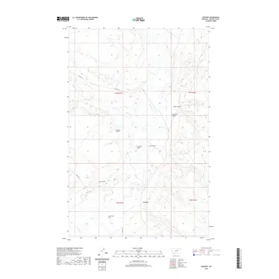
2020 Map of Content
USGS Topo · Published 2020About this map
Content marks a point of activity in the high plains of Phillips County, where the landscape is defined by the deep incisions of coulees across the prairie. This survey details a drainage network focused on Beaver Cr and Flat Cr, which navigate the wide, level expanse of the Sun Prairie Flats. The map reveals a system of named geographical landmarks like Miller Coulee, Albert Coulee, and Trueblood Coulee, names that often reflect the early ranching and homesteading families who settled this part of Montana. The primary corridor through this open country is Content Rd, which follows the natural contours between the coulee breaks and the higher flats, providing a clear record of the rural infrastructure connecting these isolated settlements and water sources.
Find a feature on this map
19 named features on this map. Tap any name to fly to it.
Don’t see what you’re looking for? This feature index may not catch every label — zoom into the map to look around manually.
Map Details
Editions of this 2020 Content Map
This is the sole edition of this map. No revisions or reprints were ever made.
Other maps of this area

1954 · Jordan
USGS Topo · 1:250,000

1954 · Glasgow
USGS Topo · 1:250,000

1956 · Jordan
USGS Topo · 1:250,000

1957 · Glasgow
USGS Topo · 1:250,000

1958 · Glasgow
USGS Topo · 1:250,000

1958 · Jordan
USGS Topo · 1:250,000

1964 · Jordan
USGS Topo · 1:250,000

1965 · Buckley Lake
USGS Topo · 1:24,000

1965 · Sheep Coulee
USGS Topo · 1:24,000
1973 · White Horse Coulee
USGS Topo · 1:24,000