1984 Map of Content
USGS Topo · Published 1984About this map
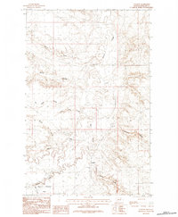
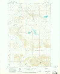
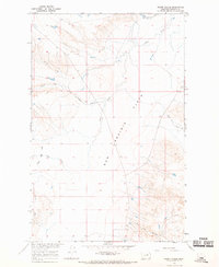
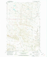
Content serves as the primary focal point of this Phillips County landscape, situated amid a complex network of seasonal drainage and prairie. The terrain is defined by its numerous coulees, such as Miller Coulee and Twin Lake Coulee, which channel water toward larger systems like Beaver Creek. The drainage patterns reveal how water management and natural topography dictated movement across this part of Montana. To the southwest, the expansive Sun Prairie Flats dominate the horizon, bounded by Tallow Creek and Flat Creek. This 1984 edition, based on earlier field checks, documents the sparse infrastructure and remote character of the area, where geographical features like D H S Creek and Smith Coulee remain the primary landmarks for navigation and land use in a region primarily shaped by its natural watercourses and open flats.
Find a feature on this map
12 named features on this map. Tap any name to fly to it.
Don’t see what you’re looking for? This feature index may not catch every label — zoom into the map to look around manually.
Map Details
Editions of this 1984 Content Map
This is the sole edition of this map. No revisions or reprints were ever made.
Other maps of this area

1954 · Jordan
USGS Topo · 1:250,000

1954 · Glasgow
USGS Topo · 1:250,000

1956 · Jordan
USGS Topo · 1:250,000

1957 · Glasgow
USGS Topo · 1:250,000

1958 · Glasgow
USGS Topo · 1:250,000

1958 · Jordan
USGS Topo · 1:250,000

1964 · Jordan
USGS Topo · 1:250,000
1965 · Buckley Lake
USGS Topo · 1:24,000
1965 · Sheep Coulee
USGS Topo · 1:24,000
1973 · White Horse Coulee
USGS Topo · 1:24,000