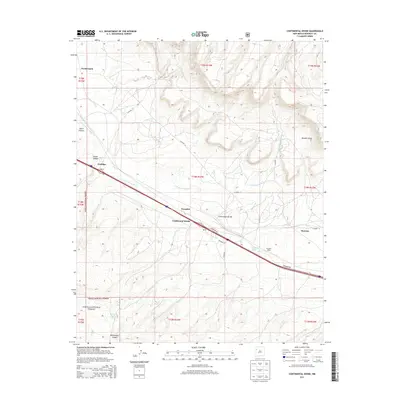
2013 Map of Continental Divide
USGS Topo · Published 2013About this map
The Continental Divide crests through this portion of the Eastern Navajo Agency, defining a landscape shaped by transportation and topographic transitions. The corridor along the S Fork Puerco River serves as a primary artery for movement, punctuated by settlements like Coolidge, Gonzales, and Thoreau. A railroad-adjacent economy is evident at Gonzales Siding, while a local Po near the divide reflects the essential infrastructure of these rural communities. To the south, the terrain rises into the Cibola National Forest, where deep cuts like Whitewater Canyon and landmarks such as Radar Tank mark the transition from the river valley to the higher forest elevations. Small water features like Gonzales Lake provide vital resources in an otherwise arid environment, illustrating the geographic constraints that have dictated the placement of homesteads and roads since the area was first settled.
Find a feature on this map
32 named features on this map. Tap any name to fly to it.
Don’t see what you’re looking for? This feature index may not catch every label — zoom into the map to look around manually.
Map Details
Editions of this 2013 Continental Divide Map
This is the sole edition of this map. No revisions or reprints were ever made.
Other maps of this area

1886 · Wingate
USGS Topo · 1:250,000

1892 · Wingate
USGS Topo · 1:250,000

1954 · Gallup
USGS Topo · 1:250,000

1958 · Gallup
USGS Topo · 1:250,000

1959 · Gallup
USGS Topo · 1:250,000

1961 · Cottonwood Canyon
USGS Topo · 1:24,000

1962 · Gallup
USGS Topo · 1:250,000

1962 · Ciniza
USGS Topo · 1:24,000

1962 · Continental Divide
USGS Topo · 1:24,000

1962 · Cottonwood Canyon
USGS Topo · 1:24,000