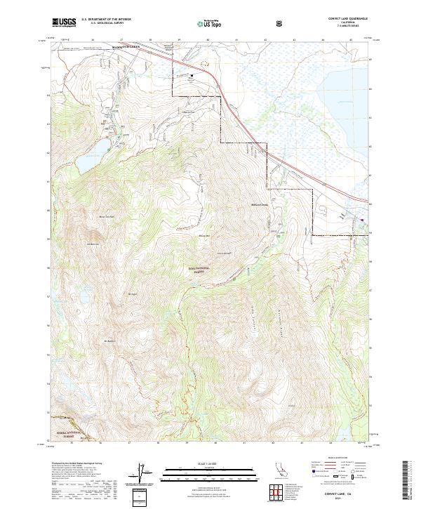
2021 Map of Convict Lake
USGS Topo · Published 2021About this map
Convict Lake sits at the heart of this high-elevation landscape, where the Sierra Nevada rises sharply from the basin floor. The settlement of McGee Creek and the nearby Tobacco Flat area occupy the transition between the valley floor and the towering peaks of the Inyo National Forest. This 2021 survey details the intricate trail network essential for navigating the complex terrain, including the Convict Lake Loop Trl and the demanding McGee Pass Trl which leads toward the Sierra National Forest boundary.
Find a feature on this map
58 named features on this map. Tap any name to fly to it.
Don’t see what you’re looking for? This feature index may not catch every label — zoom into the map to look around manually.
Map Details
Editions of this 2021 Convict Lake Map
This is the sole edition of this map. No revisions or reprints were ever made.
Other maps of this area

1912 · Mt. Goddard
USGS Topo · 1:125,000

1914 · Mt. Morrison
USGS Topo · 1:125,000

1947 · Mariposa
USGS Topo · 1:250,000

1948 · Mariposa
USGS Topo · 1:250,000

1949 · Mt. Tom
USGS Topo · 1:62,500

1951 · Mt. Tom
USGS Topo · 1:62,500

1953 · Mt. Morrison
USGS Topo · 1:62,500

1953 · Casa Diablo Mtn
USGS Topo · 1:62,500

1953 · Mt Abbot
USGS Topo · 1:62,500
1954 · Mt. Tom
USGS Topo · 1:62,500