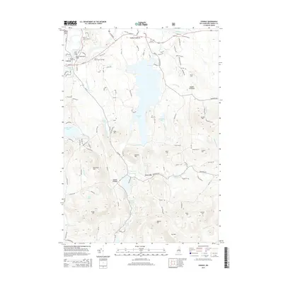
2015 Map of Conway
USGS Topo · Published 2015About this map
The Saco River and Swift River meet in the northwestern corner of this quadrangle, defining the early development of Conway. The historic Saco River Covered Bridge remains a centerpiece of the river landscape, which gives way to the expansive waters of Conway Lake and Pequawket Pond. In the southern half of the map, the terrain rises toward Foss Mtn and Lyman Mtn, with smaller settlements like Snowville and Eaton Center punctuating the wooded hills. Genealogists can find several established burial sites, including Conway Village Cem, Center Conway Cem, and the more remote Potter Cem. The network of roads such as Old Mill Rd and Henry Cotton Rd reflects a long-standing pattern of rural New Hampshire settlement where agriculture and forestry once thrived alongside the local brooks and ponds.
Find a feature on this map
118 named features on this map. Tap any name to fly to it.
Don’t see what you’re looking for? This feature index may not catch every label — zoom into the map to look around manually.
Map Details
Editions of this 2015 Conway Map
This is the sole edition of this map. No revisions or reprints were ever made.
Other maps of this area

1894 · North Conway
USGS Topo · 1:62,500

1896 · North Conway
USGS Topo · 1:62,500

1909 · Fryeburg
USGS Topo · 1:62,500

1910 · Kezar Falls
USGS Topo · 1:48,000

1911 · Fryeburg
USGS Topo · 1:62,500

1911 · Kezar Falls
USGS Topo · 1:62,500

1930 · Ossipee Lake
USGS Topo · 1:62,500

1941 · Fryeburg
USGS Topo · 1:62,500

1942 · North Conway
USGS Topo · 1:62,500

1945 · North Conway
USGS Topo · 1:62,500