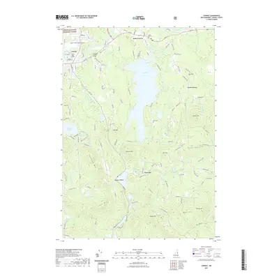
2021 Map of Conway
USGS Topo · Published 2021About this map
The Saco River winds through this corner of New Hampshire, defining a landscape where historic village centers and rugged uplands meet. In the north, the Saco River Covered Bridge connects the established settlements of Conway and Center Conway, while the southern reaches are characterized by the prominent waters of Conway Lake and smaller bodies like Hatch Pond and Long Pond. Genealogists will find several key burial sites documented, including Center Conway Cem and Potter Cem near the lake. The terrain rises sharply away from the river valleys, climbing toward Atkinson Mtn and Foss Mtn. These elevations overlook the quiet crossroads of Snowville and Eaton Center, offering a detailed view of the rural road network, such as Old Portland Rd and Baird Hill Rd, that has linked these mountain communities for generations.
Find a feature on this map
123 named features on this map. Tap any name to fly to it.
Don’t see what you’re looking for? This feature index may not catch every label — zoom into the map to look around manually.
Map Details
Editions of this 2021 Conway Map
This is the sole edition of this map. No revisions or reprints were ever made.
Other maps of this area

1894 · North Conway
USGS Topo · 1:62,500

1896 · North Conway
USGS Topo · 1:62,500

1909 · Fryeburg
USGS Topo · 1:62,500

1910 · Kezar Falls
USGS Topo · 1:48,000

1911 · Fryeburg
USGS Topo · 1:62,500

1911 · Kezar Falls
USGS Topo · 1:62,500

1930 · Ossipee Lake
USGS Topo · 1:62,500

1941 · Fryeburg
USGS Topo · 1:62,500

1942 · North Conway
USGS Topo · 1:62,500

1945 · North Conway
USGS Topo · 1:62,500