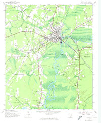
1943 Map of Conway
USGS Topo · Published 1974About this map
The Waccamaw River and Kingston Lake define the setting for Conway, South Carolina, during the early 1940s. The town serves as a hub where the Atlantic Coast Line railroad crosses the river, connecting rural settlements like Jamestown and North Conway. The landscape is dominated by an intricate network of waterways, including Crab Tree Swamp and Fourmile Swamp, which dictated the early placement of roads and homesteads.
Find a feature on this map
53 named features on this map. Tap any name to fly to it.
Don’t see what you’re looking for? This feature index may not catch every label — zoom into the map to look around manually.
Map Details
Editions of this 1943 Conway Map
3 editions found
Other maps of this area

1937 · Myrtle Beach
USGS Topo · 1:48,000

1937 · Nixonville
USGS Topo · 1:48,000

1940 · Myrtle Beach
USGS Topo · 1:62,500

1942 · Nixonville
USGS Topo · 1:62,500

1943 · Yauhannah
USGS Topo · 1:24,000

1943 · Bucksville
USGS Topo · 1:24,000

1943 · Dongola
USGS Topo · 1:24,000

1943 · Adrian
USGS Topo · 1:24,000

1943 · Horry
USGS Topo · 1:24,000

1943 · Conway
USGS Topo · 1:24,000