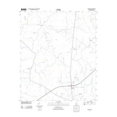
2012 Map of Conway
USGS Topo · Published 2012About this map
Redwater serves as a modern focal point in this central Mississippi landscape, situated just north of the Carthage-Leake County Airport. The area is characterized by a network of drainage systems, including the uniquely named Shaul Koli Cr and Pellaphalla Cr, which thread between rural settlements like Conway and Hopoca. Genealogists will find several burial grounds noted across the terrain, such as New Providence Cem in the west and Zion Hill Cem near the central crossroads. The road network reflects a late-20th-century transition, where established routes like Pleasant Grove Rd connect older family-named landmarks and homesteads. The topographic detail highlights the subtle elevation changes between water bodies like Pickins Cr and Town Cr, illustrating the rural development patterns of Leake County in the early 2010s.
Find a feature on this map
95 named features on this map. Tap any name to fly to it.
Don’t see what you’re looking for? This feature index may not catch every label — zoom into the map to look around manually.
Map Details
Editions of this 2012 Conway Map
This is the sole edition of this map. No revisions or reprints were ever made.
Other maps of this area

1953 · Meridian
USGS Topo · 1:250,000

1957 · Meridian
USGS Topo · 1:250,000

1961 · Carthage
USGS Topo · 1:62,500

1962 · Edinburg
USGS Topo · 1:62,500

1962 · Thomastown
USGS Topo · 1:62,500

1965 · Meridian
USGS Topo · 1:250,000

1972 · McAfee
USGS Topo · 1:24,000

1984 · Carthage
USGS Topo · 1:100,000
1988 · Thomastown
USGS Topo · 1:24,000
1989 · Ofahoma
USGS Topo · 1:24,000