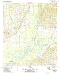
1989 Map of Ofahoma
USGS Topo · Published 1989About this map
The confluence of the Yookanookany River and the Pearl River defines this portion of central Mississippi during the late 1980s. The landscape is a intricate network of bottomland waterways and oxbows, including Elbow Lake, Horseshoe Lake, and Alligator Lake, which sit between the high ground of the Government Hills to the northeast and the river floodplains to the south. The mapping reveals a rural infrastructure centered on family and community, anchored by the Forest Grove Ch and Greenwood Ch near the Madison and Leake County lines.
Find a feature on this map
54 named features on this map. Tap any name to fly to it.
Don’t see what you’re looking for? This feature index may not catch every label — zoom into the map to look around manually.
Map Details
Editions of this 1989 Ofahoma Map
This is the sole edition of this map. No revisions or reprints were ever made.
Other maps of this area

1953 · Meridian
USGS Topo · 1:250,000

1957 · Meridian
USGS Topo · 1:250,000

1960 · Sharon
USGS Topo · 1:62,500

1961 · Carthage
USGS Topo · 1:62,500

1962 · Thomastown
USGS Topo · 1:62,500

1964 · Camden
USGS Topo · 1:24,000

1965 · Meridian
USGS Topo · 1:250,000
1966 · Goodman
USGS Topo · 1:62,500

1984 · Carthage
USGS Topo · 1:100,000
1988 · Thomastown
USGS Topo · 1:24,000