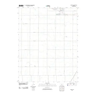
2009 Map of Conway
USGS Topo · Published 2009About this map
Conway anchors the northern edge of this McPherson County landscape, situated along a prominent east-west transportation corridor. The township's character is defined by a rigorous section-line road grid, with several routes bearing names that reflect the region's historical heritage, such as Chisholm Rd, Cimarron Rd, and Iron Horse Rd. These roads segment the terrain between the meandering courses of Blaze Fork and Wolf Creek, which cut through the agricultural plains.
Find a feature on this map
21 named features on this map. Tap any name to fly to it.
Don’t see what you’re looking for? This feature index may not catch every label — zoom into the map to look around manually.
Map Details
Editions of this 2009 Conway Map
This is the sole edition of this map. No revisions or reprints were ever made.
Other maps of this area

1891 · Hutchinson
USGS Topo · 1:125,000

1893 · Hutchinson
USGS Topo · 1:125,000

1955 · Hutchinson
USGS Topo · 1:250,000

1959 · Hutchinson
USGS Topo · 1:250,000

1964 · Windom SW
USGS Topo · 1:24,000

1964 · Conway
USGS Topo · 1:24,000

1965 · Mc Pherson South
USGS Topo · 1:24,000

1965 · Halstead NW
USGS Topo · 1:24,000
1965 · Mc Pherson North
USGS Topo · 1:24,000
1965 · Hutchinson NW
USGS Topo · 1:24,000