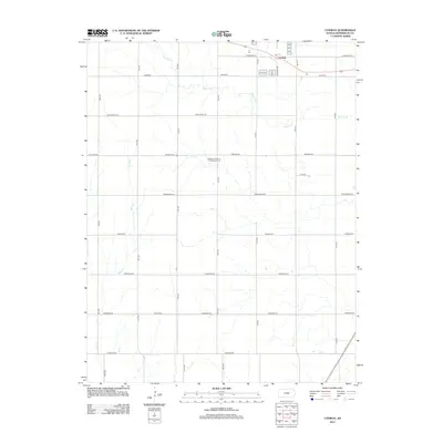
2012 Map of Conway
USGS Topo · Published 2012About this map
Conway anchors the northeast corner of this McPherson County landscape, which is defined by a rigorous grid of section-line roads and the winding paths of Blaze Fork and Wolf Cr. The intersection of modern transportation and traditional settlement is visible through the proximity of major routes like Kiowa Rd to quiet local landmarks. The map captures an area deeply rooted in community history, evidenced by the Amish Cem and the Monitor Church of the Brethren Cem, which serve as vital markers for genealogical research in this rural Kansas township.
Find a feature on this map
24 named features on this map. Tap any name to fly to it.
Don’t see what you’re looking for? This feature index may not catch every label — zoom into the map to look around manually.
Map Details
Editions of this 2012 Conway Map
This is the sole edition of this map. No revisions or reprints were ever made.
Other maps of this area

1891 · Hutchinson
USGS Topo · 1:125,000

1893 · Hutchinson
USGS Topo · 1:125,000

1955 · Hutchinson
USGS Topo · 1:250,000

1959 · Hutchinson
USGS Topo · 1:250,000

1964 · Windom SW
USGS Topo · 1:24,000

1964 · Conway
USGS Topo · 1:24,000

1965 · Mc Pherson South
USGS Topo · 1:24,000

1965 · Halstead NW
USGS Topo · 1:24,000
1965 · Mc Pherson North
USGS Topo · 1:24,000
1965 · Hutchinson NW
USGS Topo · 1:24,000