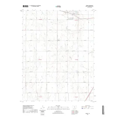
2018 Map of Conway
USGS Topo · Published 2018About this map
Conway sits in the northern reaches of this McPherson County landscape, situated along a transportation corridor defined by local landmarks like Landmark Ln. The area is characterized by a high density of historically significant sites, particularly cemeteries and religious foundations. Genealogists can find the Amish Cem and Groveland Cem, alongside the Monitor Church of the Brethren and its associated Monitor Church of the Brethren Cem. These features reflect the long-standing faith communities that established themselves among the section lines of the Public Land Survey System.
Find a feature on this map
30 named features on this map. Tap any name to fly to it.
Don’t see what you’re looking for? This feature index may not catch every label — zoom into the map to look around manually.
Map Details
Editions of this 2018 Conway Map
This is the sole edition of this map. No revisions or reprints were ever made.
Other maps of this area

1891 · Hutchinson
USGS Topo · 1:125,000

1893 · Hutchinson
USGS Topo · 1:125,000

1955 · Hutchinson
USGS Topo · 1:250,000

1959 · Hutchinson
USGS Topo · 1:250,000

1964 · Windom SW
USGS Topo · 1:24,000

1964 · Conway
USGS Topo · 1:24,000

1965 · Mc Pherson South
USGS Topo · 1:24,000

1965 · Halstead NW
USGS Topo · 1:24,000
1965 · Mc Pherson North
USGS Topo · 1:24,000
1965 · Hutchinson NW
USGS Topo · 1:24,000