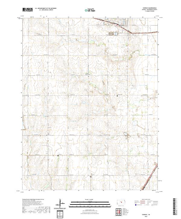
2022 Map of Conway
USGS Topo · Published 2022About this map
The settlement of Conway and the surrounding agricultural landscape of McPherson County define this portion of the Kansas prairie. Located along the northern edge of the map, Conway is centered at the junction of Antelope Trl and a primary highway, with the Blaze Fork and Wolf Cr drainage systems carving subtle patterns into the flat terrain. The area is notable for its concentration of faith-based burial sites, reflecting the diverse religious heritage of the local farming communities. Genealogists and historians will find significant sites such as the Amish Cem, the Zion Mennonite Cem, and the Monitor Church of the Brethren Cem. These landmarks, along with the West Liberty Cem and Groveland Cem, provide a clear view of how rural communities organized themselves around central places of worship and rest in this part of the state.
Find a feature on this map
33 named features on this map. Tap any name to fly to it.
Don’t see what you’re looking for? This feature index may not catch every label — zoom into the map to look around manually.
Map Details
Editions of this 2022 Conway Map
This is the sole edition of this map. No revisions or reprints were ever made.
Other maps of this area

1891 · Hutchinson
USGS Topo · 1:125,000

1893 · Hutchinson
USGS Topo · 1:125,000

1955 · Hutchinson
USGS Topo · 1:250,000

1959 · Hutchinson
USGS Topo · 1:250,000

1964 · Windom SW
USGS Topo · 1:24,000

1964 · Conway
USGS Topo · 1:24,000

1965 · Mc Pherson South
USGS Topo · 1:24,000

1965 · Halstead NW
USGS Topo · 1:24,000
1965 · Mc Pherson North
USGS Topo · 1:24,000
1965 · Hutchinson NW
USGS Topo · 1:24,000