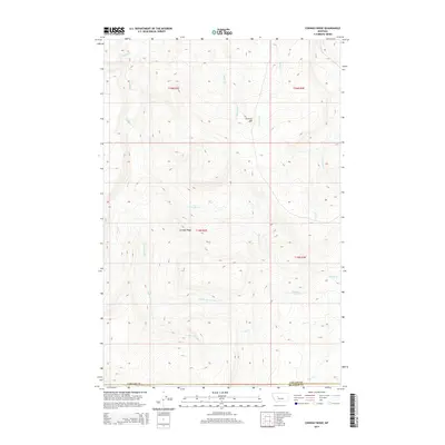
2014 Map of Conway Ridge
USGS Topo · Published 2014About this map
Conway Ridge and the high country of Cascade Co define this landscape on the edge of the Meagher County line. The terrain is deeply incised by a complex network of drainage systems, most notably Hound Creek and Government Creek, which flow through the western half of the quadrangle. In the east, Mullens Creek and Clark Creek navigate the elevations near Streeter Hill. High-elevation landmarks like Mountain Spring provide vital water sources in this dry, dissected environment. The map details the Township and Range system across T15N and T16N, illustrating the cadastral organization of these Montana uplands. This 2014 survey documents the persistence of traditional land divisions and the natural hydrology of the region, including smaller tributaries like Porcupine Creek and Coal Creek.
Find a feature on this map
20 named features on this map. Tap any name to fly to it.
Don’t see what you’re looking for? This feature index may not catch every label — zoom into the map to look around manually.
Map Details
Editions of this 2014 Conway Ridge Map
This is the sole edition of this map. No revisions or reprints were ever made.
Other maps of this area

1886 · Great Falls
USGS Topo · 1:250,000

1886 · Fort Logan
USGS Topo · 1:250,000

1948 · White Sulphur Springs
USGS Topo · 1:250,000

1954 · Great Falls
USGS Topo · 1:250,000

1957 · Great Falls
USGS Topo · 1:250,000

1958 · White Sulphur Springs
USGS Topo · 1:250,000

1961 · White Sulphur Springs
USGS Topo · 1:250,000

1961 · Schrammeck Lake
USGS Topo · 1:24,000

1961 · Dana Ranch
USGS Topo · 1:24,000

1962 · B K Ranch
USGS Topo · 1:24,000