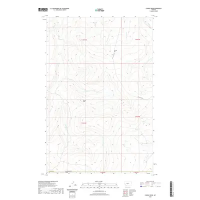
2020 Map of Conway Ridge
USGS Topo · Published 2020About this map
Conway Ridge dominates this portion of Cascade County, where the high plains of central Montana give way to complex drainage networks. This 2020 landscape is defined by its water sources and livestock-rearing potential, featuring numerous seasonal and perennial flows such as Hound Cr and Porcupine Cr. The presence of the uniquely named Mowing Machine Coulee at the southern edge suggests the area's agricultural utility and the practical naming conventions of local ranchers. Access is primarily facilitated by Upper Millegan Rd, which traverses the eastern slopes. Notable landmarks for orientation include Streeter Hill in the northeast and Mountain Spring to the southeast, illustrating a terrain where reliable water points are essential for land management. The grid of the Public Land Survey System, including Township 15 North, Range 2 East, provides a structured framework over the otherwise fluid topography of ridges and creeks.
Find a feature on this map
23 named features on this map. Tap any name to fly to it.
Don’t see what you’re looking for? This feature index may not catch every label — zoom into the map to look around manually.
Map Details
Editions of this 2020 Conway Ridge Map
This is the sole edition of this map. No revisions or reprints were ever made.
Other maps of this area

1886 · Great Falls
USGS Topo · 1:250,000

1886 · Fort Logan
USGS Topo · 1:250,000

1948 · White Sulphur Springs
USGS Topo · 1:250,000

1954 · Great Falls
USGS Topo · 1:250,000

1957 · Great Falls
USGS Topo · 1:250,000

1958 · White Sulphur Springs
USGS Topo · 1:250,000

1961 · White Sulphur Springs
USGS Topo · 1:250,000

1961 · Schrammeck Lake
USGS Topo · 1:24,000

1961 · Dana Ranch
USGS Topo · 1:24,000

1962 · B K Ranch
USGS Topo · 1:24,000