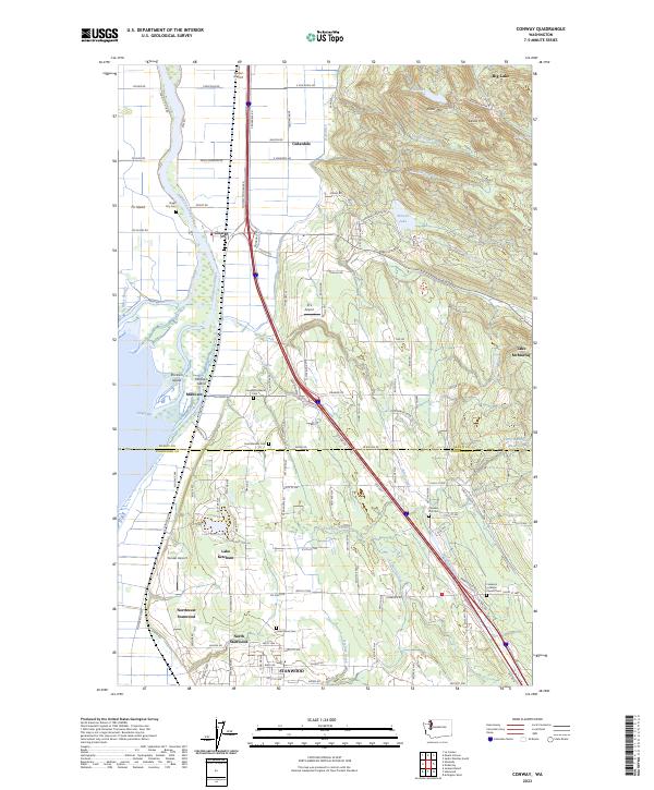
2023 Map of Conway
USGS Topo · Published 2023About this map
The deltaic landscape where the South Fork Skagit River meets Skagit Bay defines this corner of the Pacific Northwest, showcasing a complex network of waterways like Freshwater Slough and Wiley Slough. The rural communities of Conway, Milltown, and Cedardale are situated along the transport corridor created by the BNSF Railway and old highway routes, bridging the fertile flats with the rising timbered slopes of Scott Mtn and Devils Mtn.
Find a feature on this map
100 named features on this map. Tap any name to fly to it.
Don’t see what you’re looking for? This feature index may not catch every label — zoom into the map to look around manually.
Map Details
Editions of this 2023 Conway Map
This is the sole edition of this map. No revisions or reprints were ever made.
Other maps of this area

1911 · Mount Vernon
USGS Topo · 1:125,000

1940 · Mt Vernon
USGS Topo · 1:62,500

1941 · Marysville
USGS Topo · 1:62,500

1943 · Marysville
USGS Topo · 1:62,500

1943 · Mt Vernon
USGS Topo · 1:62,500

1943 · Stanwood
USGS Topo · 1:62,500

1944 · Clear Lake
USGS Topo · 1:62,500

1956 · Arlington West
USGS Topo · 1:24,000
1956 · Stanwood
USGS Topo · 1:24,000
1956 · Utsalady
USGS Topo · 1:24,000