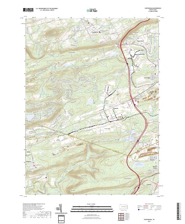
2023 Map of Conyngham
USGS Topo · Published 2023About this map
Conyngham lies at the intersection of mountain ridges and creek valleys, serving as a hub for the residential and industrial corridors of the West Hazleton area. The landscape is defined by the sharp rise of Sugarloaf Mountain to the northwest and the long stretch of Buck Mountain and Pismire Ridge through the center, separating the Black Creek drainage from the southern Catawissa Creek basin. The transition from industrial development to conservation is evident in the presence of the Horse Shoe Swamp and the several reservoirs, including Grape Run Reservoir and Number Eight Reservoir, that dot the higher elevations.
Find a feature on this map
153 named features on this map. Tap any name to fly to it.
Don’t see what you’re looking for? This feature index may not catch every label — zoom into the map to look around manually.
Map Details
Editions of this 2023 Conyngham Map
This is the sole edition of this map. No revisions or reprints were ever made.
Other maps of this area

1889 · Hazleton
USGS Topo · 1:62,500

1891 · Wilkesbarre
USGS Topo · 1:62,500

1891 · Hazleton
USGS Topo · 1:62,500

1892 · Mahanoy
USGS Topo · 1:62,500

1893 · Hazleton
USGS Topo · 1:62,500

1893 · Mahanoy
USGS Topo · 1:62,500

1894 · Shickshinny
USGS Topo · 1:62,500

1894 · Wilkesbarre
USGS Topo · 1:62,500

1943 · Scranton
USGS Topo · 1:125,000

1944 · Newark
USGS Topo · 1:250,000
Featured Places
- Conyngham, PA
- Sheppton, East Union Township
- Haddock, Kline Township
- East Union Township, PA
- North Union Township, PA