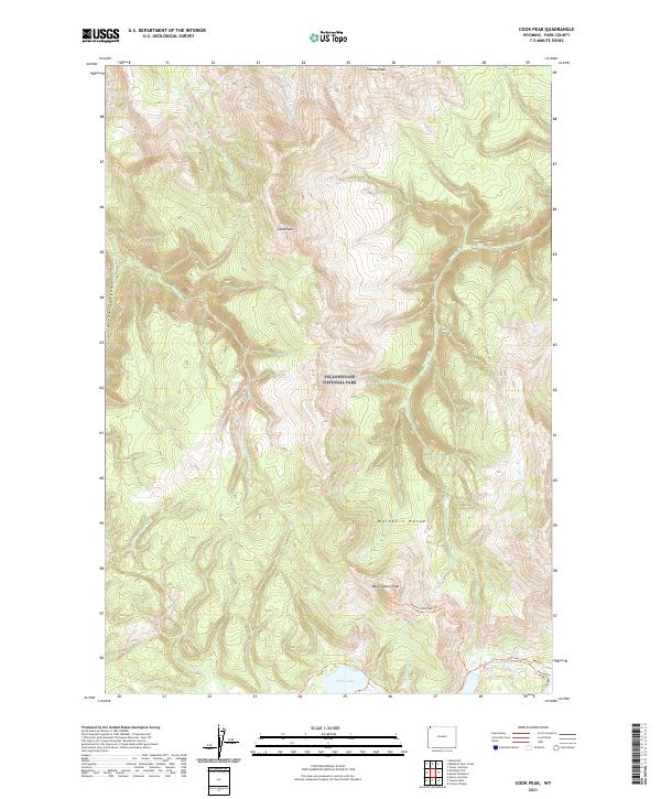
2021 Map of Cook Peak
USGS Topo · Published 2021About this map
Yellowstone National Park terrain dominates this 2021 study of Park County, centering on the high elevations of the Washburn Range. The landscape is defined by a complex network of drainages including Lava Cr, Lupine Cr, and Blacktail Deer Cr, which flow from prominent summits like Cook Peak and Folsom Peak. These peaks form a central massif where the headwaters of the Gibbon River begin their descent. In the southern portion of the quadrangle, Grebe Lake serves as a major hydrological feature near the intersection of the Observation Peak Trl and Cascade Lake Trl. The map illustrates the remote character of this region, emphasizing the natural topography of Arrow Canyon and Observation Peak without modern road development, maintaining the wilderness character preserved within the park boundaries.
Find a feature on this map
23 named features on this map. Tap any name to fly to it.
Don’t see what you’re looking for? This feature index may not catch every label — zoom into the map to look around manually.
Map Details
Editions of this 2021 Cook Peak Map
This is the sole edition of this map. No revisions or reprints were ever made.
Other maps of this area

1885 · Gallatin
USGS Topo · 1:125,000

1885 · Gallatin
USGS Topo · 1:125,000

1886 · Canyon
USGS Topo · 1:125,000

1895 · Canyon
USGS Topo · 1:125,000

1896 · Canyon
USGS Topo · 1:125,000

1901 · Canyon
USGS Topo · 1:125,000

1901 · Gallatin
USGS Topo · 1:125,000

1907 · Canyon
USGS Topo · 1:125,000

1908 · Gallatin
USGS Topo · 1:125,000

1911 · Gallatin
USGS Topo · 1:125,000