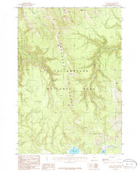
1986 Map of Cook Peak
USGS Topo · Published 1986About this map
The high ridges of the Washburn Range dominate this 1986 topographic study of Yellowstone National Park. Rising toward the prominent summit of Cook Peak, the landscape is defined by the headwaters of several major waterways, including Lava Creek, Tower Creek, and the Gibbon River. The interior terrain is accessible via a established network of routes, most notably the Pack Trail, which winds through the elevations near Observation Peak. At lower elevations, the map records high-altitude bodies of water such as Grebe Lake and Cascade Lake, the latter of which feeds into Cascade Creek. The presence of a footbridge near the southern boundary highlights the essential infrastructure maintained for travel within this protected wilderness area during the late twentieth century.
Find a feature on this map
16 named features on this map. Tap any name to fly to it.
Don’t see what you’re looking for? This feature index may not catch every label — zoom into the map to look around manually.
Map Details
Editions of this 1986 Cook Peak Map
This is the sole edition of this map. No revisions or reprints were ever made.
Other maps of this area

1885 · Gallatin
USGS Topo · 1:125,000

1885 · Gallatin
USGS Topo · 1:125,000

1886 · Canyon
USGS Topo · 1:125,000

1895 · Canyon
USGS Topo · 1:125,000

1896 · Canyon
USGS Topo · 1:125,000

1901 · Canyon
USGS Topo · 1:125,000

1901 · Gallatin
USGS Topo · 1:125,000

1907 · Canyon
USGS Topo · 1:125,000

1908 · Gallatin
USGS Topo · 1:125,000

1911 · Gallatin
USGS Topo · 1:125,000