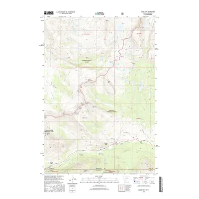
2017 Map of Cooke City
USGS Topo · Published 2017About this map
Cooke City and Silver Gate serve as the primary human outposts in this high-altitude alpine landscape at the Montana-Wyoming border. This 2017 survey captures a geography defined by its transitions between four massive public lands: Yellowstone National Park, and the Custer, Gallatin, and Shoshone National Forests. The region's mining legacy and rugged access are reflected in the concentration of high-mountain passes and historic routes such as Lulu Pass, Daisy Pass, and the Bannock Trl. The map details a dense network of alpine lakes, including Goose Lake and Courthouse Lake, which feed the headwaters of the Stillwater River and Goose Cr. This specific cartography is essential for tracing the modern footprints of historic settlements and the cemetery that anchors the local history of the Soda Butte Canyon area.
Find a feature on this map
87 named features on this map. Tap any name to fly to it.
Don’t see what you’re looking for? This feature index may not catch every label — zoom into the map to look around manually.
Map Details
Editions of this 2017 Cooke City Map
This is the sole edition of this map. No revisions or reprints were ever made.
Other maps of this area

1886 · Canyon
USGS Topo · 1:125,000

1891 · Livingston
USGS Topo · 1:250,000

1893 · Livingston
USGS Topo · 1:250,000

1895 · Canyon
USGS Topo · 1:125,000

1896 · Canyon
USGS Topo · 1:125,000

1896 · Crandall Creek
USGS Topo · 1:125,000

1898 · Granite Mountain District
USGS Topo · 1:125,000

1899 · Crandall
USGS Topo · 1:125,000

1901 · Canyon
USGS Topo · 1:125,000

1907 · Canyon
USGS Topo · 1:125,000