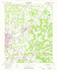
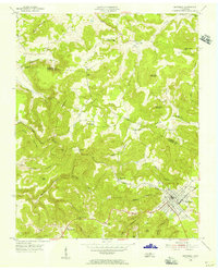
1953 Map of Cookeville East
USGS Topo · Published 1975About this map
Cookeville and the adjacent town of Algood serve as the focal points for this 1950s survey of the Upper Cumberland, capturing a moment of transition where established rural communities met post-war expansion. The map details a dense network of family landmarks and local institutions, ranging from Post Oak Ch and Burtons Chapel to the Putnam County Airport. The terrain is defined by the ascent from the city toward the high ridges of Green Mountain and Buck Mountain, where small settlements like Verble and Bangham are situated near the Overton Co Putnam Co line.
Find a feature on this map
77 named features on this map. Tap any name to fly to it.
Don’t see what you’re looking for? This feature index may not catch every label — zoom into the map to look around manually.
Map Details
Editions of this 1953 Cookeville East Map
5 editions found
Other maps of this area

1897 · Standingstone
USGS Topo · 1:125,000

1898 · Standingstone
USGS Topo · 1:125,000

1925 · Gainesboro
USGS Topo · 1:62,500

1929 · Gainesboro
USGS Topo · 1:62,500

1943 · Cookeville
USGS Topo · 1:100,000

1944 · Cookeville
USGS Topo · 1:100,000

1951 · Windle
USGS Topo · 1:24,000

1953 · Cookeville East
USGS Topo · 1:24,000

1953 · Cookeville West
USGS Topo · 1:24,000
1955 · Monterey Lake
USGS Topo · 1:24,000