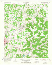
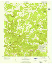
1953 Map of Cookeville East
USGS Topo · Published 1968About this map
The Tennessee Central RR cuts a diagonal path through the landscape of the eastern Highland Rim, connecting the rising hub of Cookeville with the railroad town of Algood. In the early 1950s, this area reflects a transition from rural homesteading to mid-century development, evidenced by the clustered community institutions like Burtons Chapel, Swallows Sch, and the Putnam County Airport. The terrain is defined by the sharp descent into Madewell Hollow and Turkey Hollow, where small family cemeteries such as Bohannon Cem and Lyles Cem dot the ridges. Municipal infrastructure of the era is prominent, from the Cookeville Filtration Plant near City Lake to the Cookeville Armory, marking the city's role as a regional administrative and utility center.
Find a feature on this map
73 named features on this map. Tap any name to fly to it.
Don’t see what you’re looking for? This feature index may not catch every label — zoom into the map to look around manually.
Map Details
Editions of this 1953 Cookeville East Map
5 editions found
Other maps of this area

1897 · Standingstone
USGS Topo · 1:125,000

1898 · Standingstone
USGS Topo · 1:125,000

1925 · Gainesboro
USGS Topo · 1:62,500

1929 · Gainesboro
USGS Topo · 1:62,500

1943 · Cookeville
USGS Topo · 1:100,000

1944 · Cookeville
USGS Topo · 1:100,000

1951 · Windle
USGS Topo · 1:24,000

1953 · Cookeville East
USGS Topo · 1:24,000

1953 · Cookeville West
USGS Topo · 1:24,000
1955 · Monterey Lake
USGS Topo · 1:24,000