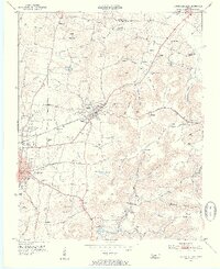
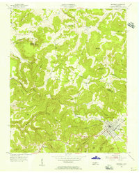
1953 Map of Cookeville East
USGS Topo · Published 1955About this map
The Tennessee Central Railroad serves as the industrial spine for this portion of Putnam County, threading through Cookeville and Algood before climbing toward the plateau at Brotherton. The landscape is a mix of growing municipal infrastructure and deep-rooted rural settlements, evidenced by the Putnam County Airport and the Cookeville Filtration Plant alongside numerous family cemeteries like Pearson Cem and Norris Cem.
Find a feature on this map
84 named features on this map. Tap any name to fly to it.
Don’t see what you’re looking for? This feature index may not catch every label — zoom into the map to look around manually.
Map Details
Editions of this 1953 Cookeville East Map
5 editions found
Other maps of this area

1897 · Standingstone
USGS Topo · 1:125,000

1898 · Standingstone
USGS Topo · 1:125,000

1925 · Gainesboro
USGS Topo · 1:62,500

1929 · Gainesboro
USGS Topo · 1:62,500

1943 · Cookeville
USGS Topo · 1:100,000

1944 · Cookeville
USGS Topo · 1:100,000

1951 · Windle
USGS Topo · 1:24,000

1953 · Cookeville East
USGS Topo · 1:24,000

1953 · Cookeville West
USGS Topo · 1:24,000
1955 · Monterey Lake
USGS Topo · 1:24,000