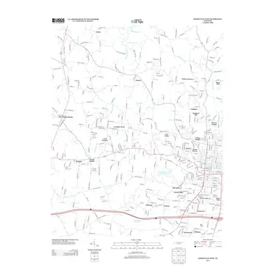
2013 Map of Cookeville West
USGS Topo · Published 2013About this map
Cummins Falls and the winding reaches of Blackburn Fork define the northern landscape of this region during the early twenty-first century. As the suburban expansion of Cookeville moves westward, a patchwork of established neighborhoods and newer residential developments like Shepherd Hills, Melrose, and Tanglewood fill the terrain between the interstate and the rural highlands. The geography is marked by numerous watercourses, including Cane Cr and Hudgens Cr, which drain toward the prominent Cane Creek Lake.
Find a feature on this map
322 named features on this map. Tap any name to fly to it.
Don’t see what you’re looking for? This feature index may not catch every label — zoom into the map to look around manually.
Map Details
Editions of this 2013 Cookeville West Map
This is the sole edition of this map. No revisions or reprints were ever made.
Other maps of this area

1897 · Standingstone
USGS Topo · 1:125,000

1898 · Standingstone
USGS Topo · 1:125,000

1925 · Gainesboro
USGS Topo · 1:62,500

1929 · Gainesboro
USGS Topo · 1:62,500

1943 · Cookeville
USGS Topo · 1:100,000

1944 · Cookeville
USGS Topo · 1:100,000

1951 · Windle
USGS Topo · 1:24,000

1953 · Cookeville East
USGS Topo · 1:24,000

1953 · Cookeville West
USGS Topo · 1:24,000
1955 · Windle
USGS Topo · 1:24,000