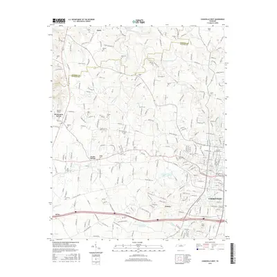
2016 Map of Cookeville West
USGS Topo · Published 2016About this map
Cookeville and its western outskirts serve as a central hub in this detailed look at mid-century Tennessee growth, where the campus of Tennessee Technological Univ meets the expanding residential and commercial corridors of Putnam County. The landscape is defined by the winding paths of Blackburn Fork and Cane Creek, which drain the undulating terrain north of Baxter. Smaller settlements like Bloomington Springs and Double Springs maintain their distinct identities even as the regional infrastructure intensifies around the Interstate 40 corridor.
Find a feature on this map
259 named features on this map. Tap any name to fly to it.
Don’t see what you’re looking for? This feature index may not catch every label — zoom into the map to look around manually.
Map Details
Editions of this 2016 Cookeville West Map
This is the sole edition of this map. No revisions or reprints were ever made.
Other maps of this area

1897 · Standingstone
USGS Topo · 1:125,000

1898 · Standingstone
USGS Topo · 1:125,000

1925 · Gainesboro
USGS Topo · 1:62,500

1929 · Gainesboro
USGS Topo · 1:62,500

1943 · Cookeville
USGS Topo · 1:100,000

1944 · Cookeville
USGS Topo · 1:100,000

1951 · Windle
USGS Topo · 1:24,000

1953 · Cookeville East
USGS Topo · 1:24,000

1953 · Cookeville West
USGS Topo · 1:24,000
1955 · Windle
USGS Topo · 1:24,000