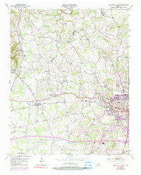
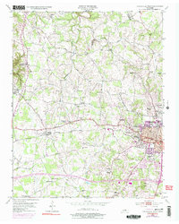
1953 Map of Cookeville West
USGS Topo · Published 1990About this map
The western edge of Cookeville serves as the focal point of this mid-century survey, dominated by the campus of the Tennessee Polytechnic Institute and the essential infrastructure of a growing regional hub. The landscape is defined by the Louisville and Nashville railroad corridor and a dense concentration of local institutions, including the General Hospital, County Home, and several high schools. Beyond the city center, the terrain transitions into a patchwork of family-named cemeteries and rural congregations that trace the settlement history of Putnam County. To the northwest, Bloomington Springs and the Junior Military Academy stand out as distinct landmarks, while the rural north is crisscrossed by branches of the Blackburn Fork and the historic Old Gainesboro Road. This map documents a period before major interstate development, showing the original road-and-rail network that connected isolated churches like Post Oak Shade Ch and Knight Chapel to the urbanizing core.
Find a feature on this map
73 named features on this map. Tap any name to fly to it.
Don’t see what you’re looking for? This feature index may not catch every label — zoom into the map to look around manually.
Map Details
Editions of this 1953 Cookeville West Map
6 editions found
Other maps of this area

1897 · Standingstone
USGS Topo · 1:125,000

1898 · Standingstone
USGS Topo · 1:125,000

1925 · Gainesboro
USGS Topo · 1:62,500

1929 · Gainesboro
USGS Topo · 1:62,500

1943 · Cookeville
USGS Topo · 1:100,000

1944 · Cookeville
USGS Topo · 1:100,000

1951 · Windle
USGS Topo · 1:24,000

1953 · Cookeville East
USGS Topo · 1:24,000

1953 · Cookeville West
USGS Topo · 1:24,000
1955 · Windle
USGS Topo · 1:24,000