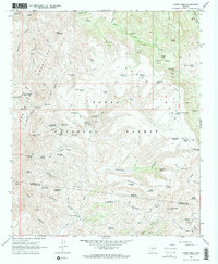
1967 Map of Cooks Mesa
USGS Topo · Published 1968About this map
Tonto National Forest land dominates this 1960s landscape, where a sophisticated network of water management features supported livestock and early habitation across the arid Yavapai County terrain. The survey identifies numerous named tanks and springs, such as Cooks Mesa Tank No 1, Picket Corral Tank, and Homestead Spring, which were vital for survival in this environment. The drainage patterns are clearly defined by Squaw Creek and the upper reaches of the New River, with distinctive landforms like The Island and Six Bar Ridge providing natural navigation markers. Evidence of human activity and infrastructure is found at the Road Junction Windmill and scattered Mine and Prospect sites. This map captures the area just before modern development began to reach deeper into the high desert, documenting the precarious balance of water sources and the network of Pack Trails and Jeep Trails that connected these remote desert outposts.
Find a feature on this map
91 named features on this map. Tap any name to fly to it.
Don’t see what you’re looking for? This feature index may not catch every label — zoom into the map to look around manually.
Map Details
Editions of this 1967 Cooks Mesa Map
2 editions found
Other maps of this area

1887 · Verde
USGS Topo · 1:250,000

1887 · Prescott
USGS Topo · 1:250,000

1892 · Verde
USGS Topo · 1:250,000

1892 · Prescott
USGS Topo · 1:250,000

1903 · Bradshaw Mountains
USGS Topo · 1:125,000

1929 · Turret Peak
USGS Topo · 1:125,000

1930 · Cave Creek
USGS Topo · 1:125,000

1933 · Turret Peak
USGS Topo · 1:125,000

1939 · Cave Creek
USGS Topo · 1:125,000

1947 · Bumblebee
USGS Topo · 1:62,500