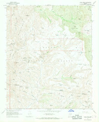
1967 Map of Cooks Mesa
USGS Topo · Published 1968About this map
Tonto National Forest lands dominate this high-elevation landscape along the border of Yavapai and Maricopa counties. The 1967 survey reveals a network of canyons and mesas, defined by steep drainages like Squaw Creek Canyon and Grapevine Canyon. The scarcity of water in this arid environment is evidenced by the density of named water sources, including Goat Camp Spring, Cavness Spring, and Laurel Hole Spring, which served as vital points for cattle ranching and travel.
Find a feature on this map
88 named features on this map. Tap any name to fly to it.
Don’t see what you’re looking for? This feature index may not catch every label — zoom into the map to look around manually.
Map Details
Editions of this 1967 Cooks Mesa Map
2 editions found
Other maps of this area

1887 · Verde
USGS Topo · 1:250,000

1887 · Prescott
USGS Topo · 1:250,000

1892 · Verde
USGS Topo · 1:250,000

1892 · Prescott
USGS Topo · 1:250,000

1903 · Bradshaw Mountains
USGS Topo · 1:125,000

1929 · Turret Peak
USGS Topo · 1:125,000

1930 · Cave Creek
USGS Topo · 1:125,000

1933 · Turret Peak
USGS Topo · 1:125,000

1939 · Cave Creek
USGS Topo · 1:125,000

1947 · Bumblebee
USGS Topo · 1:62,500