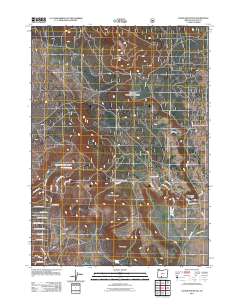
2011 Map of Cooks Mountain
USGS Topo · Published 2011About this map
Cooks Mountain and Horse Butte dominate this section of Klamath County, where the high desert landscape is defined by volcanic features and sparse water sources. The map reveals a specialized network of roads and trails with names that evoke the region’s wildlife and cultural history, such as Indian Circle Dr, Tepee Ln, and Moccasin Ln. These paths weave through the undulating terrain near Buckmaster Point, providing access to critical water points like Dibbon Cook Spring and Chipps Spring.
Find a feature on this map
38 named features on this map. Tap any name to fly to it.
Don’t see what you’re looking for? This feature index may not catch every label — zoom into the map to look around manually.
Map Details
Editions of this 2011 Cooks Mountain Map
This is the sole edition of this map. No revisions or reprints were ever made.
Other maps of this area

1889 · Klamath
USGS Topo · 1:250,000

1894 · Klamath
USGS Topo · 1:250,000

1955 · Klamath Falls
USGS Topo · 1:250,000

1956 · Calimus Butte
USGS Topo · 1:62,500

1957 · Swan Lake
USGS Topo · 1:62,500

1958 · Klamath Falls
USGS Topo · 1:250,000

1960 · Beatty
USGS Topo · 1:62,500

1960 · Fuego Mountain
USGS Topo · 1:62,500

1980 · Williamson River
USGS Topo · 1:100,000
1985 · Sprague River West
USGS Topo · 1:24,000