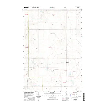
2014 Map of Cooks
USGS Topo · Published 2014About this map
The Hiawatha National Forest blankets this Upper Peninsula landscape, where the settlements of Cooks, Elkhorn, and Springer sit amidst a dense network of inland water bodies. For genealogists and local historians, the map identifies three distinct burial sites: Cooks Cem, Old Cooks Cem, and the Seventh Day Adventist Cem. The terrain is defined by a complex drainage system including the Little Fishdam River, Spring Cr, and Archambeau Cr, which feed into numerous basins like Ninemile Lake and Michaud Lake. The transition between Delta and Schoolcraft counties is clearly marked by the Delta Co Schoolcraft Co boundary, illustrating the jurisdictional divide across this timbered region. Local transportation is represented by rural corridors such as Garden Grade Rd and Flodin Rd, which provide access to the remote forest interior and smaller lakes like Tighe Lake and Grass Lake.
Find a feature on this map
28 named features on this map. Tap any name to fly to it.
Don’t see what you’re looking for? This feature index may not catch every label — zoom into the map to look around manually.
Map Details
Editions of this 2014 Cooks Map
This is the sole edition of this map. No revisions or reprints were ever made.
Other maps of this area

1931 · Cooks NE
USGS Topo · 1:31,680

1931 · Steuben SE
USGS Topo · 1:31,680

1931 · Steuben SW
USGS Topo · 1:31,680

1931 · Cooks NW
USGS Topo · 1:31,680

1932 · Skeels Lake SE
USGS Topo · 1:31,680

1932 · Garden SE
USGS Topo · 1:31,680

1932 · Garden NE
USGS Topo · 1:31,680

1954 · Escanaba
USGS Topo · 1:250,000

1957 · Escanaba
USGS Topo · 1:250,000

1958 · Escanaba
USGS Topo · 1:250,000